Agua Mansa Pioneer Cemetery
Certified Site, California Historical Landmark no. 121
Address
2001 Agua Mansa Road, Colton, CA 92324
(909) 798-8608
Directions
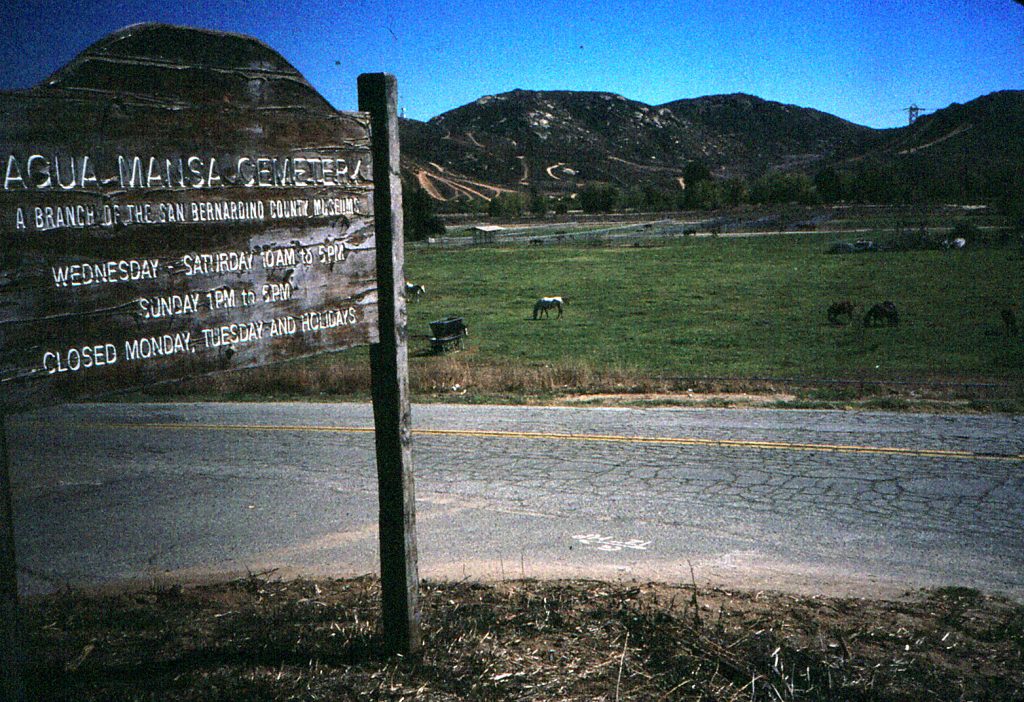
Plan Your Trip Ahead
Contact the main museum at (909) 798-8608 to ensure this site is open on the day you would like to visit, as we may experience temporary closures due to high wind or other factors during the year.
Hours
This site will be closed May 17, 2026.
- Sundays through Thursdays: 10 a.m. to 3 p.m.
- Closed on all County-observed holidays.
- Group tours by appointment.
Admission Fees: No Cost
Historic Preservation
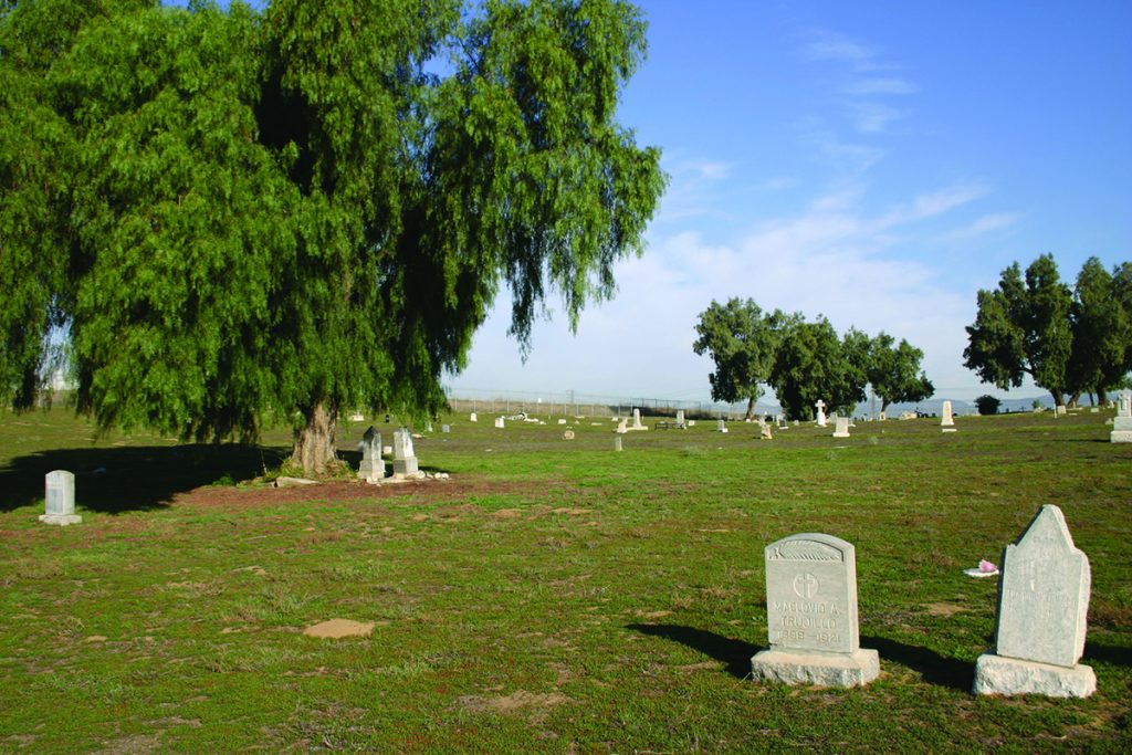
San Bernardino County Museum is committed to historic preservation, and rehabilitating Agua Mansa Pioneer Cemetery is part of that important work. Part of the rehabilitation process included a full archaeological pedestrian survey, marker recording and mapping, and ground-penetrating radar (GPR). GPR is often used in archaeological sites to identify and map unmarked burials buried deep under the surface. In our case, hundreds of unmarked graves were found that, because of erosion and the sandy terrain, had been covered for years.

Explore Agua Mansa Pioneer Cemetery Burials
This collection contains burial information for multiple family members in the Agua Mansa Pioneer Cemetery. Burial records range from 1854-1963 and burial records continue to be updated as information becomes available.
Note: The online database represents identified burials at the Agua Mansa Pioneer Cemetery. Some gravesites have not been identified.
Please direct questions to the Curator of History, Drisel Perez.
- January 1st (New Year’s Day)
- Third Monday in January (Martin Luther King Jr. Day)
- Third Monday in February (President’s Day)
- Easter Sunday
- Last Monday in May (Memorial Day)
- June 19 (Juneteenth)
- July 4th (Independence Day)
- First Monday in September (Labor Day)
- Second Monday in October (Columbus Day)
- November 11th (Veterans Day)
- Third Thursday in November (Thanksgiving Day)
- Third Friday in November (Day After Thanksgiving)
- December 24th (Day Before Christmas)
- December 25th (Christmas Day)
- December 31st ( Day Before New Year’s)
The communities of Agua Mansa and La Placita, across from each other along the Santa Ana River, were the first non-native settlements in the San Bernardino Valley and had the first church and school. These villages were the largest settlement between New Mexico, and Los Angeles during the 1840s. Today, the Agua Mansa Pioneer Cemetery is all that remains of these once- thriving communities.
Antonio Maria Lugo and Juan Bandini established the San Bernardino and Jurupa ranchos on former Mission San Gabriel property in the 1830s. By offering land, they convinced a group from Abiquiu, New Mexico, to settle on the upper Santa Ana River and serve as a buffer against raiders and outlaws along the trading route from Santa Fe to Los Angeles. The emigrants first colonized Politana on the Rancho San Bernardino in 1842. Ten of these families, led by Lorenzo Trujillo, moved from Politana to 2,000 acres on the “Bandini Donation” on the east side of the river, on the northern boundary of the Jurupa Rancho. This village was known as “La Placita de los Trujillos”, later called La Placita. A second group moved to the west side of the river at Agua Mansa, and by 1845 the twin communities were firmly established. Farmsteads were laid out, an extensive irrigation system was dug, and grapes, grain, vegetables, and fruit trees were planted. Horses, sheep, and cattle were pastured on the mesa to the southeast, at present-day Riverside.
Agua Mansa flourished until January 1862, when a great flood filled the Santa Ana River from bluff to bluff and destroyed the west bank community, leaving only the cemetery, the chapel, and Cornelius Jensen’s adjoining store, built in 1854. Most of the homes in La Placita were also damaged or destroyed. Although rebuilt, the farming community never regained its importance. The coming of the railroad, the rise of the cement industry, and the expansion of the citrus industry drew people away from these two farming communities. La Placita was a recognized community of Riverside until 1926. The Trujillo cantina closed in World War II, and the last burial in the cemetery occurred in 1963.
La Placita’s first church was a brush-covered enramada (bower or arbor). A permanent adobe church was built near the river bank in 1852; it collapsed in quicksand the day after the last row of adobe bricks was placed. Work on a third church, this time on the Agua Mansa side of the river, started immediately. The 11′ by 58′ chapel was completed in 1853 and dedicated in 1857 as “San Salvador”. The chapel withstood the 1862 flood, although the water rose to its steps. In fact, the ringing church bell alerted the Agua Mansans to the impending flood, and all escaped without loss of life. In 1867, however, the parish was moved to San Bernardino, and by 1883 the chapel stood abandoned and crumbling.
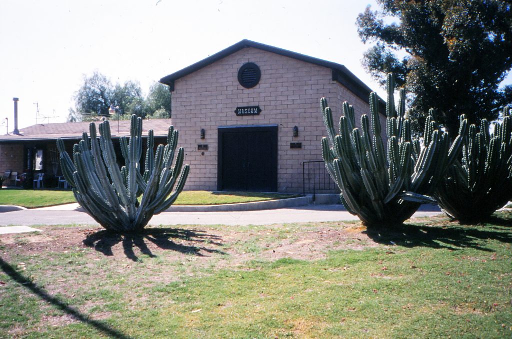
In an effort to stem vandalism, “Friends for the Preservation of the Agua Mansa Pioneer Cemetery” was formed in 1955 by Marie Espinosa Wood, a descendent of two of the original families. Through hard work and fund raising, these volunteers researched the land title, built a bridge, and fenced and refurbished the cemetery. In 1967, Agua Mansa Pioneer Cemetery was acquired by San Bernardino County and is now administered as a museum branch of the San Bernardino County Museum. With the help of Friends of Agua Mansa Pioneer Cemetery, a full-size replica of the San Salvador church was constructed and dedicated in 1978 within the cemetery boundaries and is used today as a museum.
Agua Mansa Pioneer Cemetery is today an oasis with its many markers in Spanish and natural setting providing a respectful glimpse into the past. Watch for a listing of those buried at Agua Mansa Pioneer Cemetery on this web site in the future.
To learn more about the Agua Mansa Pioneer Cemetery, we recommend the following San Bernardino County Museum Association Quarterlies by Dr. Bruce Harley:
- The Agua Mansa History Trail, Vol. 43(3), 1996
- From New Mexico to California: San Bernardino Valley’s First Settlers at Agua Mansa, Vol. 47(3, 4), 2000
- Women in Agua Mansa History 1838-1997 Vol. 49(2), 2002