Daytripper
Keaton Macon
On view Oct 3 – January 10, 2026
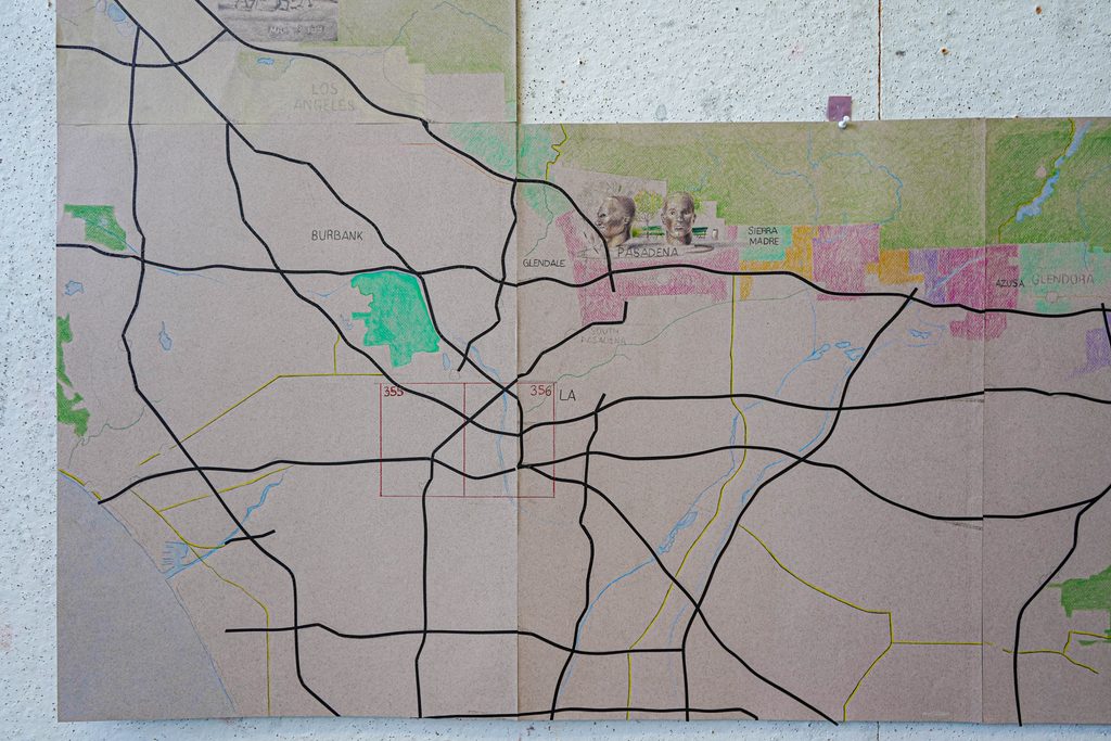
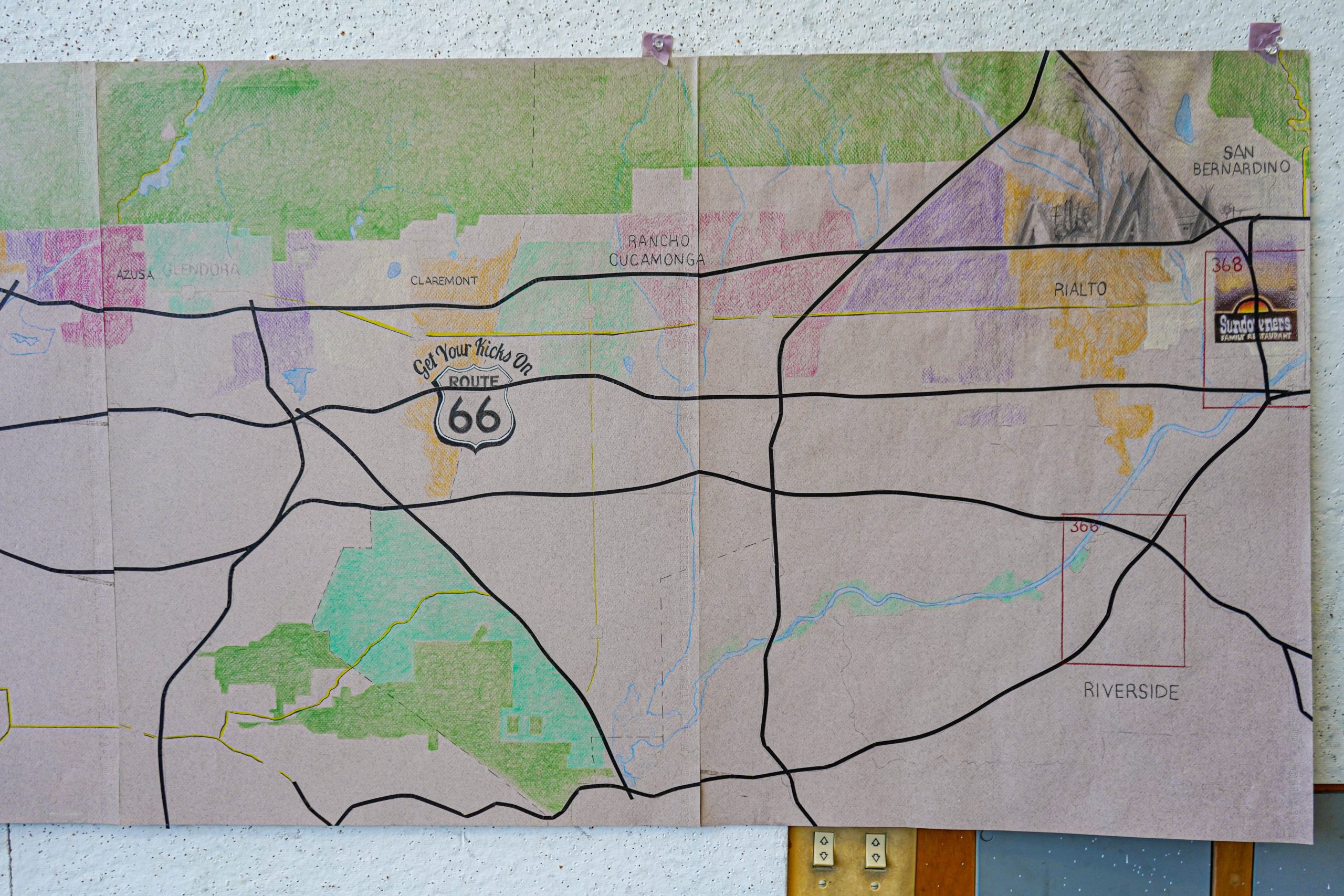
In Daytripper, Keaton Macon uses large-scale hand-drawn maps to explore how movement shapes our understanding of place. Following familiar highways and roads, his drawings trace routes that connect landscapes, communities, and layers of history.
Reminiscent of the spiral-bound Thomas Guide map books that were once found in many Southern California cars, Macon joins multiple sheets into irregular shapes that follow the region’s major thoroughfares. These routes pass through changing geological, historical, socio-economic, and political landscapes, revealing how much can shift within a single day’s travel.
The Thomas Guide
Before digital maps became commonplace, how did we navigate the complex roads that connect us?
For many motorists, it was paper road maps or atlases. One of the most popular ones in California was the Thomas Guide.
Founded in Oakland by three brothers, the Thomas Guide is a series of folding maps and spiralbound atlases that featured detailed maps of the largest metropolitan areas in the United States. In Southern California, these atlases were almost ubiquitous in people’s backseats and glove compartments. Businesses would even use the Thomas Guide map grids for their location in advertisements.
Route 66
Established in 1926, Route 66 connected the Great Lakes to the Pacific Ocean. In California, Route 66 crossed the Mojave Desert, passed through the Cajon Pass, and ended in Santa Monica. Known as the “Mother Road” and “Main Street of America,” the highway traced the paths first tread by indigenous groups and later reinforced by waves of settlers who came by wagon, then by train, and finally by automobile. They travelled for many reasons: depression-era farmers in search of a better life, soldiers serving their country, free spirits looking for adventure.
Much of the original Route 66 was replaced by interstate highways eventually leading to its removal from the U.S. Highway System in 1985. Still, at 100 years old, its legacy lives throughout the County as portions of the Mother Road in San Bernardino County remain drivable today as the National Trails Highway, State Route 66, and Foothill Boulevard.
About the Artist
Keaton Macon is an interdisciplinary artist working with images and installation. He uses drawings, objects and sound to point to historical events and collective memory, and the gaps and overlaps in experience and knowledge that they produce. These arrangements often skirt attempts at piecing events back together, in favor of producing sensorial experiences that ground the viewer in the now.
Macon uses materials that aim to give form to concepts like memory, time and space. Constructed and ready-made sculptures often have an aesthetic of authority. Wood and plexiglass casings, indexical tape recordings, rented TV props all point to the tools of documentation and representation. Macon’s installations put these cold objects into conversation with the more interpretive two-dimensional works to produce meanings that are both fact and fiction.
About the Exhibition
Objects and images from SBCM’s permanent collections are shown alongside these drawings, providing tangible landmarks and connections to places along these routes and highlighting the histories embedded in the landscapes we move through every day.